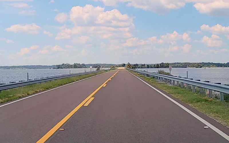
Highway 43 is more than a route across the Reservoir. For many locals, it is the place where the picture in front of the windshield begins to change. South of the highway, broad open water supplies the dominant view. North of it, channels, timber and vegetation make the Pearl River easier to see inside the lake. The transition is not a hard boundary, but it is clear enough to shape the way we give directions. “Above 43” tells a Reservoir person something.
The Mississippi Department of Wildlife, Fisheries and Parks describes roughly 9,000 acres north of Highway 43 as riverine habitat. That official language matches the view from the road: narrower lines of water, more turns and a landscape less dominated by one long horizon. The upper Reservoir is not the main lake with fewer houses. It has its own geography and habits.
The Drive Deserves the Driver’s Attention
Fog, sunset and open views can make the crossing beautiful enough to distract. Use designated legal places to stop rather than slowing unpredictably or pulling onto an unsafe shoulder for a photograph. Watch for changing light, wildlife and vehicles entering from local roads. Give trailers, farm vehicles and work trucks room to turn and stop. The people behind those wheels are using a daily route, not moving through a scenic exhibit.
Weather often shows itself clearly across the water. A dark line of rain or wind marking the surface can make every passenger look, which is one more reason the driver should keep eyes on the road. In heavy rain, increase distance and reduce speed before visibility disappears. Do not assume the bridge or causeway will feel like the protected road you just left. Open water changes the exposure.
Above the Highway, Plans Change Too
Boaters heading upriver should expect conditions different from the lower lake. Current, vegetation, submerged timber and narrower routes deserve current charts, local information and conservative navigation. A track saved from an earlier trip does not guarantee the same path remains clear. Know the boat and the passengers, check weather and water conditions, and turn around before uncertainty becomes trouble. Familiarity works best when it produces caution.
Anglers use Highway 43 as more than a road reference because habitat changes around it. Reports may distinguish the main lake, areas above the highway and upriver sections. Reading those descriptions accurately prevents a tip from being applied to the wrong kind of water. “The fish are shallow” still requires asking where. On a 33,000-acre Reservoir, location is part of every pattern.
The Communities Carry a Different Pace
Farther north, the Reservoir can feel less like the edge of metro Jackson and more like a river corridor connecting smaller communities, long-held properties and working land. Daily routines do not revolve around the same businesses or traffic patterns as the lower lake. People may reach the water through a different launch, road and set of landmarks. The common name “the Rez” holds those experiences together without making them identical.
That difference is worth respecting in local coverage. An event, closure or weather observation on one side of Highway 43 should not be described as though it applies to every shoreline. Use specific place names and recognize that “up the Reservoir” is home, not empty space between better-known destinations. Local news becomes more useful when it knows which local it means.
Crossing Highway 43 gives us a quick lesson in the size and variety of the place. The broad lower lake remains behind, the river’s influence becomes more visible and the communities along the route begin telling a different story. The highway does not divide two Reservoirs. It helps us see why one Reservoir can mean several different landscapes to the neighbors who live around it.